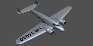
 One of the enduring uncertainties regarding our Amelia Earhart search project is the issue of whether the L-10E Electra broke into pieces upon impact, and, whether or not, how long did it float? We know the prevailing winds and currents well enough to estimate the impact of float time on the search area, if we can get a better handle on the time. We have always assumed the plane would sink rather quickly, and would probably remain largely intact, but this is based entirely on anecdotal evidence. We have recently selected a proposal by Iowa State University to “conduct deeper research into the structural failure of Amelia Earhart’s Lockheed L-10E airplane, relative to the dump valves and associated fuel tanks. The structural failure analysis of the valves will be useful in providing the fill rate and float time when the aircraft crashed into the ocean. This information contributes to the ongoing search analysis for Amelia Earhart’s plane.” The project would include creating a CAD model, performance of simulations, and construction and testing of a prototype tank and dump valve system to test static and dynamic forces on the tanks.
Iowa State University Lockheed Electra Structural Analysis
 One of the enduring uncertainties regarding our Amelia Earhart search project is the issue of whether the L-10E Electra broke into pieces upon impact, and, whether or not, how long did it float? We know the prevailing winds and currents well enough to estimate the impact of float time on the search area, if we can get a better handle on the time. We have always assumed the plane would sink rather quickly, and would probably remain largely intact, but this is based entirely on anecdotal evidence. We have recently selected a proposal by Iowa State University to “conduct deeper research into the structural failure of Amelia Earhart’s Lockheed L-10E airplane, relative to the dump valves and associated fuel tanks. The structural failure analysis of the valves will be useful in providing the fill rate and float time when the aircraft crashed into the ocean. This information contributes to the ongoing search analysis for Amelia Earhart’s plane.” The project would include creating a CAD model, performance of simulations, and construction and testing of a prototype tank and dump valve system to test static and dynamic forces on the tanks.

 The image at right, from
